Digital City Concept Proposal SUN/SHADE MAP
Concept
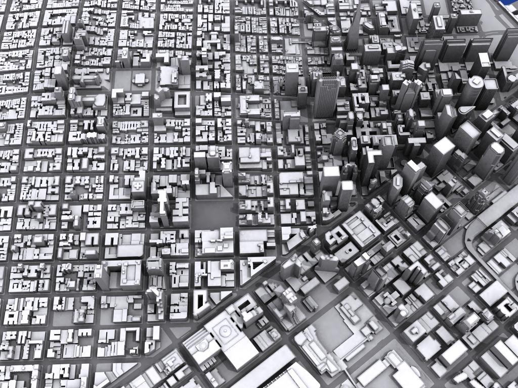
An interactive map concept that uses the San Francisco Digital City 3D model to search for directions in the city, and lets the user know how much sunlight or shade they receive during their travel. Depending on time of day, certain streets (especially streets downtown near high buildings) will only have direct sunlight on the street level during mid day, while neighborhoods with shorter buildings (such as the Mission or the Sunset) will have much more direct sunlight. Light can change depending on both the hills of SF and structures such as buildings, bridges, and tunnels. Users would also be able to select a specific area of the city or neighborhood, and see the shade/sun on all streets in that area depending on current time. There is a subtle irony in the concept due to the foggy nature of San Francisco – days with direct sunlight with no fog or clouds are rare and treasured.
Result
There is a wealth of information to be gathered by sun and shade calculations, and it would be interesting for us to see which parts of the city get the most sun and shade during the entire year. They would be able to view the result as an interactive Google Map, a 3D image, a sequence of stills, or an animation of shadows. It would also be interesting to be able to download a screensaver that shows all the shadows in the city for the current time of day. Unfortunately the map does not take fog or clouds into account. It will be up to the user to look outside and determine if it’s actually a sunny day.
Technical
Calculations of shade and direct sunlight would be based on time of day and the season, which users can change when searching. The route will be drawn as a line that changes between two colors. One color signifies sunlight, while another color signifies shade. The route will be created with Google Maps, so users will have the ability to drag and modify the suggested route depending if they want a route with more shade, or more sun. The light ratio will update as you drag the route around the city. Also, a calculation of “time travelled” will have to be included to determine how the shade will change by the time you actually reach your destination.
Many larger streets, such as Market st or Van Ness have the possibility of sun on only one side of the street. The map would take this into consideration, and render the route in that area as two stripes side by side, showing which side is sunny.
Animations of timelaps, movies, stills, RSS feeds, and illustrations of sunlight and shade movement would be incorporated into the map results. Because of the extremely detailed 3D map of SF, the resulting route could be rendered in 3D with realistic computer generated shadows, in addition to the traditional Google Map. Because sunlight and shade loops throughout a full year, the sunlight/shade data can be pre-calculated for all 365 days throughout the entire year and stored on our server. This means the main calculation being done per user is to test if a path moves through a sunny part of the city.
This map could be a useful tool to visualize how new construction projects (such as the proposed Transbay Terminal) in San Francisco would effect shade in the city. As SF’s skyline changes, so does the amount of shade being cast on the sidewalk.